

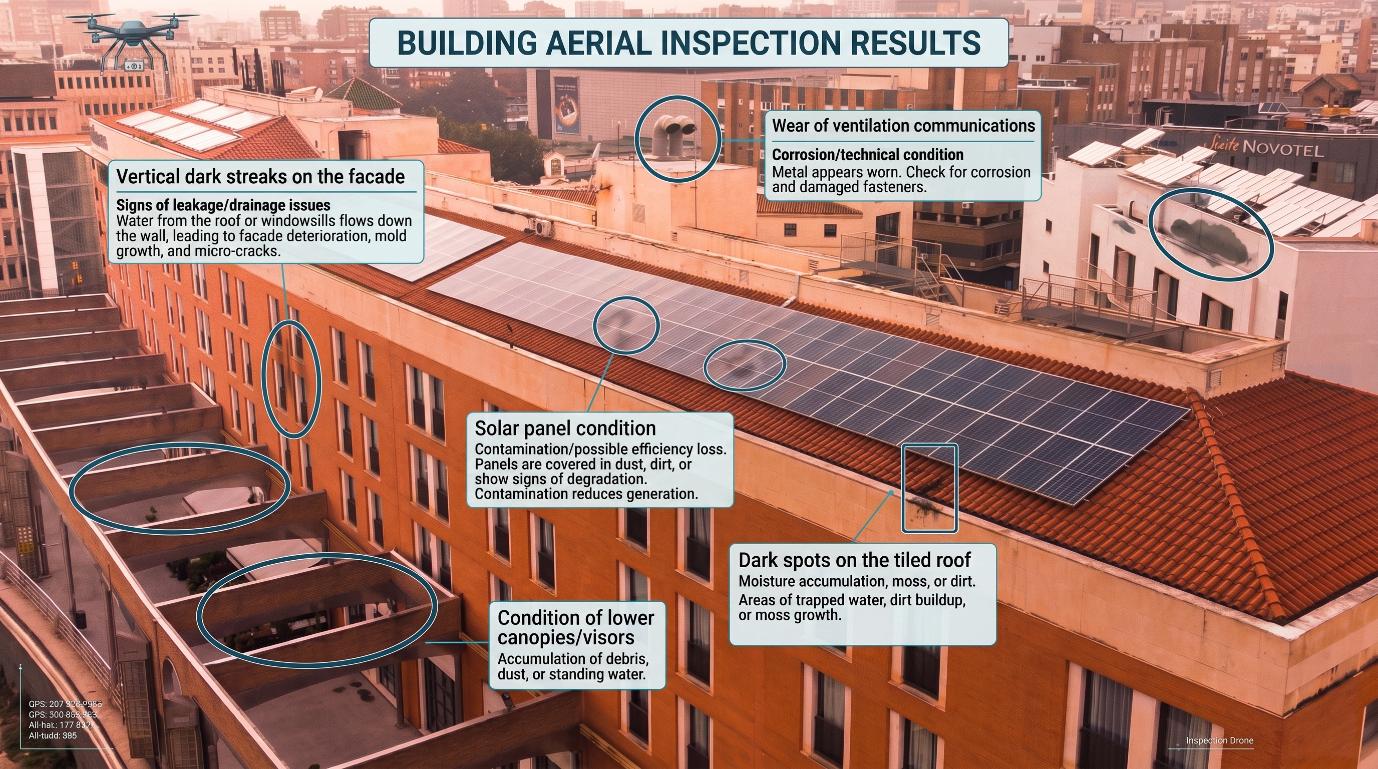
Detailed Drone Aerial Inspection
What it is
Professional site aerial inspection is the precise evaluation of buildings, infrastructure, and industrial zones from the air. Drone filming allows for the quick detection of defects and damage, enabling technical state assessments without halting facility operations.
How it is done
- Low-altitude drone flight with high resolution (4K / 48MP).
- Filming critical elements: roofs, facades, chimneys, structural components, and hard-to-reach areas.
- Using multiple angles to ensure complete coverage of the facility.
- Photo post-processing: correction, detail enhancement, and AI-assisted analysis.
What it is for
Detecting cracks, corrosion, leaks, deformations, and thermal losses. Ideal for technical inspections, aerial photography, and infrastructure condition monitoring.
Orthomosaic and 3D Model of the Object
What it is
An accurate, georeferenced orthomosaic map or 3D model of the object built from hundreds of photos. Used in construction, engineering, cadastre, and urban planning.
How it is done
- Grid mission flight path with 70–80% overlap.
- Collecting hundreds of images from various altitudes and angles.
- Processing in Pix4D, DroneDeploy, or Metashape.
- Generation of:
- Orthomosaic — a flat map with 1–3 cm/px accuracy.
- 3D Model — a realistic reconstruction of the building or territory.
What it is for
Construction, measurements, technical documentation, visualization, and site monitoring. A key tool for drone construction monitoring.
Technical Report Based on Aerial Survey
What it is
A structured technical report with photo evidence, findings, and recommendations. Generated based on aerial photography, video, and 3D data.
How it is done
- Analysis of photos, videos, and 3D models.
- Detecting defects, risks, changes, and anomalies.
- Creating a PDF report containing:
- facility description;
- identified issues;
- annotated photos;
- recommendations;
- conclusions.
What it is for
For contractors, engineers, developers, and insurance companies. Highly suited for infrastructure inspection using drones.
Dynamic Construction Monitoring
What it is
Regular survey flights for construction monitoring and progress tracking on-site. It allows you to monitor progress, document work volumes, and ensure process transparency.
How it is done
- Drone flight along an identical trajectory (saved mission).
- Capturing photos and videos from identical vantage points.
- Material comparison:
- work progress;
- structural changes;
- completed volumes;
- site dynamics.
What it is for
Contractor control, investor reporting, and work planning. An essential tool for drone construction supervision.